OGC API is a family of standards based on OpenAPI. Its purpose is to define resource-centric APIs that take advantage of modern web development practices.
All OGC APIs are based on OpenAPI “a standard, language-agnostic interface to RESTful APIs which allows both humans and computers to discover and understand the capabilities of the service without access to source code, documentation, or through network traffic inspection.”
In particular, this means OGC APIs:
Provide an API definition that is both machine-parseable and human-readable.
Each resource has a representation, typical choices are HTML and JSON. HTML allows direct exploration of the API in a browser, while JSON is used by machine-to-machine communication.
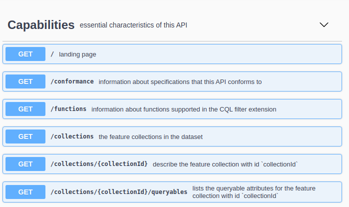
OGC API - Features landing page, in its HTML representation, from GeoServer.
OGC APIs are split into a small core and a set of optional extensions.
The core is meant to be minimal and easy to implement: it should be possible to implement a new server in a matter of days.
For reference, OGC API - Features core provides, in terms of data access, only the following:
Paged data access
Filtering by bounding box and and time
The service works in CRS84 only (both output and filtering)
The extensions cover optional functionality that a server might implement. Many of these were part of the core functionality, in classic OGC services. For example, OGC API - Features extensions (existing and planned) include:
Property selection
CRS by reference (support CRS other than CRS84)
CQL Filtering
Transactions
A client can discover which extensions are implemented by a server exploring the “conformance declaration”, a dedicated resource enumerating all implemented conformance classes.
A specification might indicate one or more conformance classes for its implementation, for example, supporting the HTML representation of resources
adds its own conformance class, http://www.opengis.net/spec/ogcapi-features-1/1.0/conf/html.
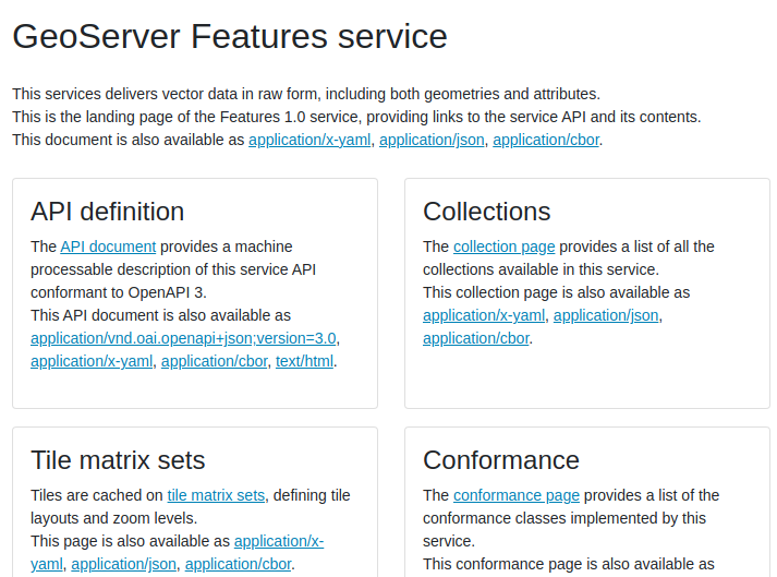
Sample conformance classes from GeoServer OGC API - Features.
Representations of resources are, whenever possible, linked with each other.
This makes the service “browseable”, either by actually using a browser,
or by following links embedded in JSON representations.
The rel attribute, relationship, indicates the nature of the link.
For example, the landing page links to the OpenAPI description of the service using a relationship service-desc:
{"href":"https://gs-main.geosolutionsgroup.com/geoserver/ogc/features/v1/openapi?f=application%2Fvnd.oai.openapi%2Bjson%3Bversion%3D3.0","rel":"service-desc","type":"application/vnd.oai.openapi+json;version=3.0","title":"API definition for this endpoint as application/vnd.oai.openapi +json;version=3.0"}
Links are also used to point to representations of the same resource in different formats, using the alternate relationship.
The representation is chosen by using the HTTP Accept header. This means a browser will automatically receive back a HTML representation, if available.
Representations can be commonly chosen also by using a query parameter, which is chosen by the server implemtation (OGC API - Commons suggests using either “f” or “Accept”, GeoServer users the former).
OGC API - Commons defines the basics shared by all OGC APIs.
In terms of resource representation, it reccommends support for HTML and JSON representations. However, that is not mandated: a service that can represent its resources only using Protocol buffers (for the sake of picking an example) is an equivally valid implementation.