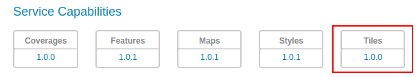
The API provides tiles of geospatial information, such as vector data (Vector Tiles) and raster data (Map Tiles)
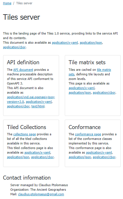
The OGC API Tiles Service is accessed via the TILES version 1.0 link on the home page.
The landing page (at http://localhost:8083/geoserver/ogc/tiles/v1) provides clients with a starting point for using the API, through a collection of resources, with links for navigation between content.
The following screenshot shows the HTML representation of the landing page.
The landing page can also be represented as json, e.g.. http://localhost:8083/geoserver/ogc/tiles/v1?f=application/json. This representation provides the same information, in a form suitable for programmatic access by web developers.
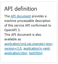
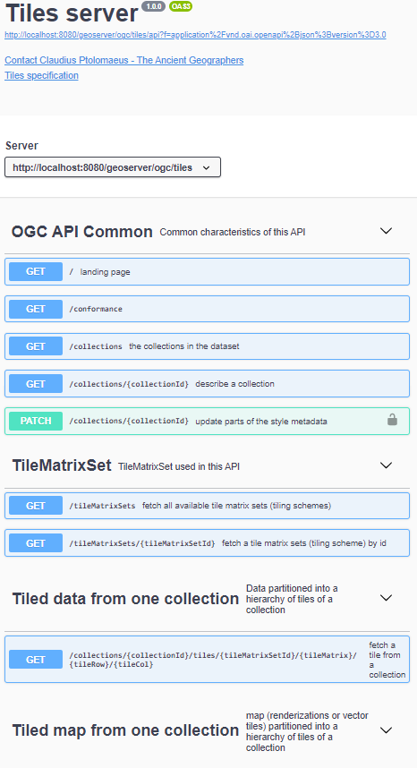
The API definition provides an OpenAPI description of the service is provided, that may be browsed as documentation, or used to generate a client to access the web services.
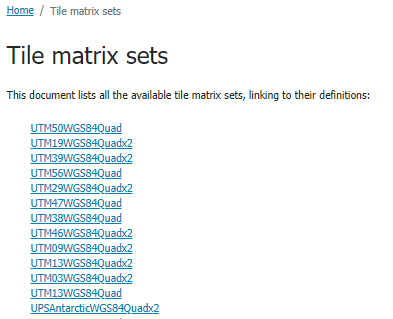
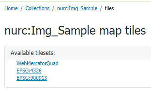
The Tile matrix sets link provides the list of available tiling schemes:
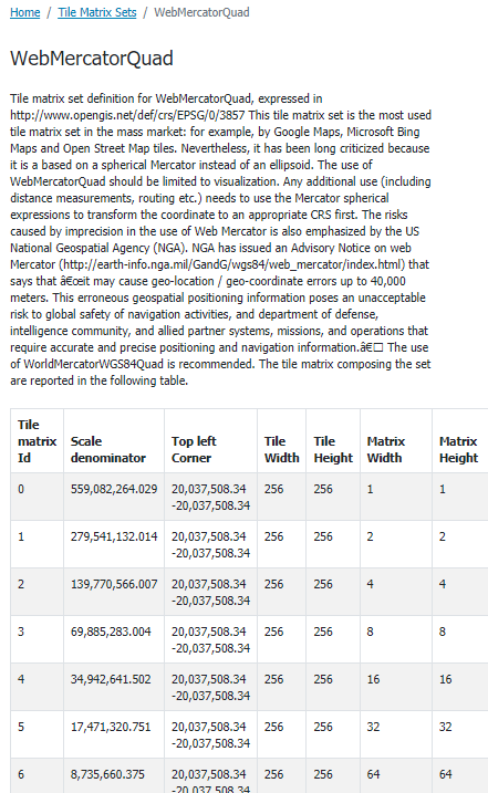
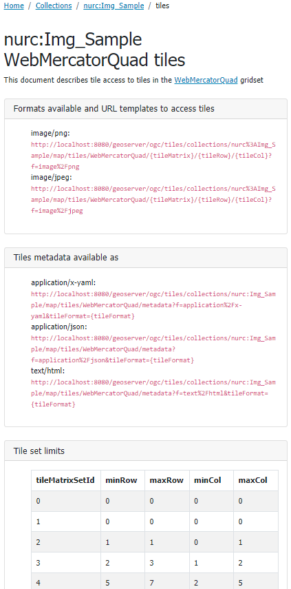
Selecting one of the entries from the list, i.e. WebMercatorQuad, provides the details for that Tile matrix set,
showing the different zoom level properties and tiling layout.
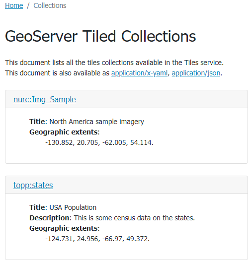
OGCAPI-tiles provides access to collections of geospatial data. A collection is a generic concept for a set of related resources/items.
A collection can thus be a Tiles Collection.
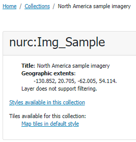
For each configured tiled layer in GeoServer a collection is provided. Each collection entry is described using the corresponding layer details: title, description, geographic extent.
Metadata for vector tiles also contains a vector_layers section, reporting additional metadata and available fields for the vector data.
This page reports TileJSON metadata including the vector_layers content:
{"tilejson":"2.2.0","name":"topp:states","description":"This is some census data on the states.","scheme":"xyz","tiles":["http://localhost:8083/geoserver/ogc/tiles/v1/collections/topp%3Astates/tiles/WebMercatorQuad/{z}/{y}/{x}?f=application%2Fvnd.mapbox-vector-tile"],"center":[-89.9999999749441,42.52556437629473,1.0],"bounds":[-124.731422,24.955967,-66.969849,49.371735],"format":"application/vnd.mapbox-vector-tile","minzoom":0,"maxzoom":24,"vector_layers":[{"id":"states","description":"This is some census data on the states.","fields":{"STATE_NAME":"string","STATE_FIPS":"string","HOUSHOLD":"number","EMPLOYED":"number","CARPOOL":"number","PERSONS":"number","WORKERS":"number","LAND_KM":"number","P_FEMALE":"number","SAMP_POP":"number","STATE_ABBR":"string","UNEMPLOY":"number","MALE":"number","FEMALE":"number","WATER_KM":"number","SUB_REGION":"string","DRVALONE":"number","FAMILIES":"number","SERVICE":"number","MANUAL":"number","P_MALE":"number","PUBTRANS":"number"},"minzoom":0,"maxzoom":24,"geometry_type":"polygon"}]}
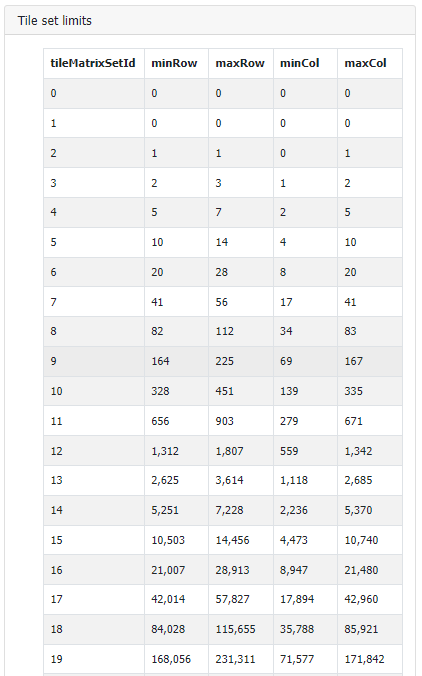
In case the tiled collection isn’t fully covering the whole tile matrix set domain, limits are reported as a table, containing min and max grid coordinates for each supported level.